Antarctic ice Sheet Stability from continental Slope Processes investigation.
|
Project Acronym &Title: ANTSSS – Antarctic ice Sheet Stability from continental Slope Processes investigation |
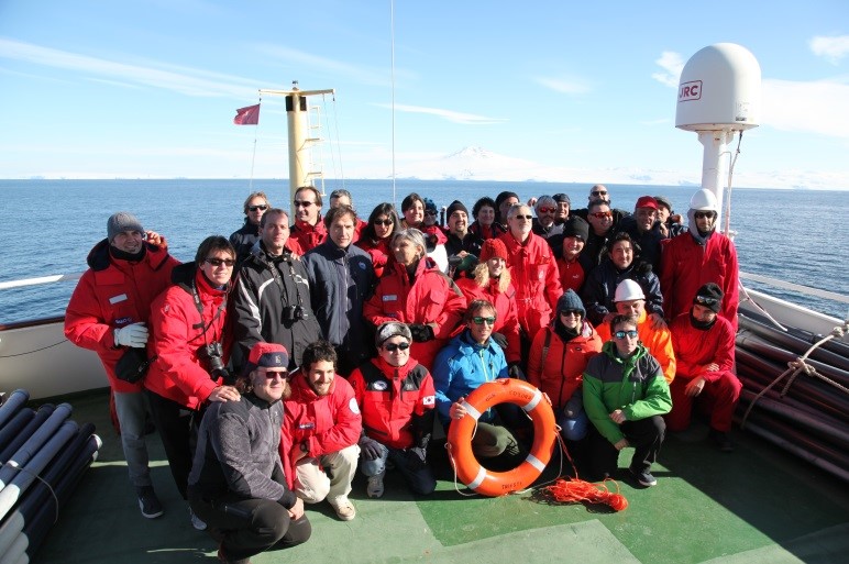   |
| Jenny Gales, National Oceanography Centre, Southampton “Good weather and a significant lack of sea ice allowed us to collect an excellent geophysical and oceanographic dataset from the Hillary Canyon during the EUROFLEETS2-ANTSSS project. The enthusiasm and dedication of the multi-disciplinary and international science team, technicians, Captain and the officers and crew of R/V OGS Explora made this a hugely successful expedition. The results will be used to help understand past and modern processes operating within the Hillary Canyon and will also help to constrain sites for future planned drilling as part of the International Ocean Discovery Program – Expedition 374 scheduled for January 2018.” |
 |
Main Objectives
|
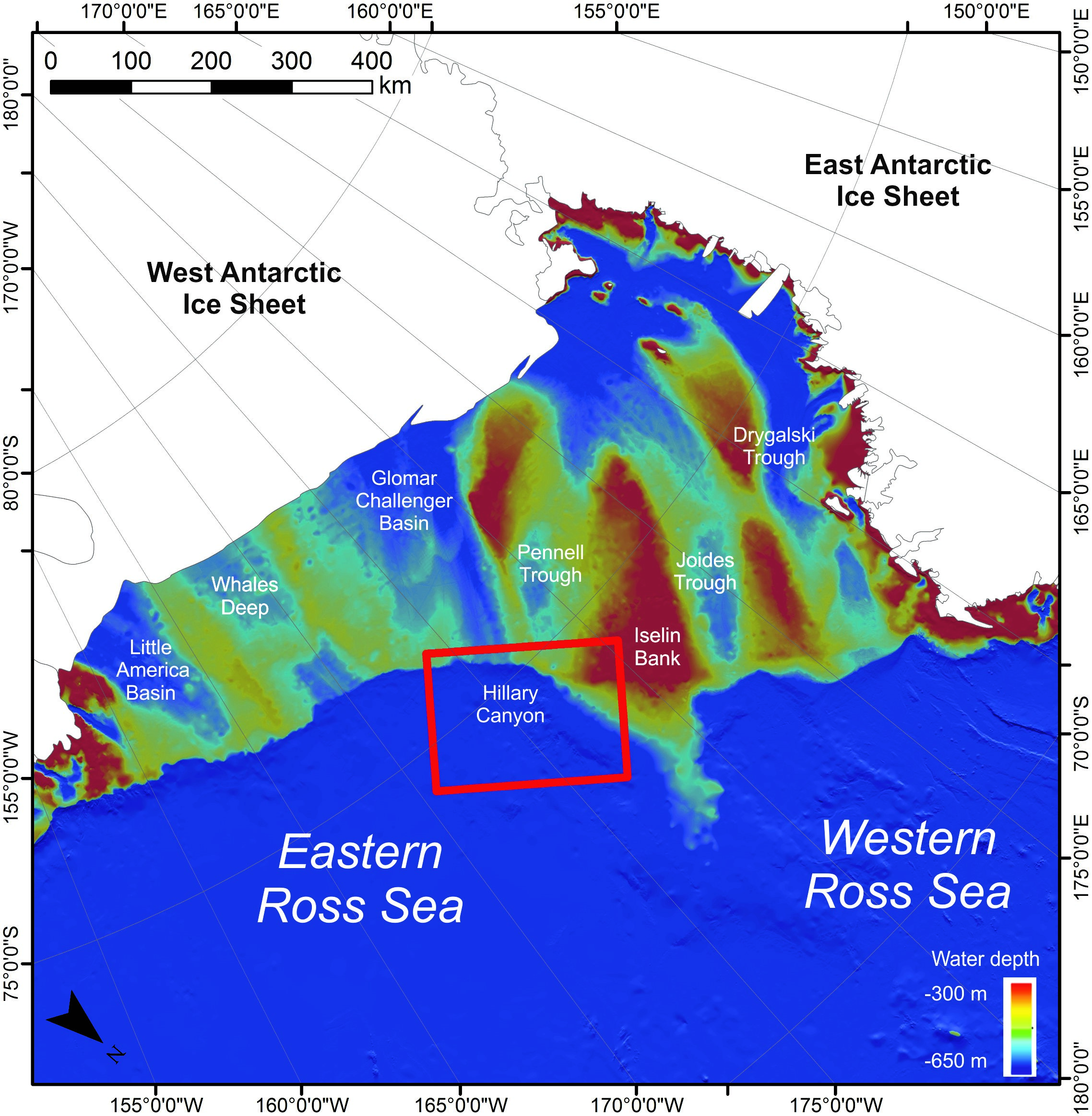
The main objective of the expedition was to collect new geophysical data from an underexplored area of the Ross Sea continental margin. Particular focus areas were deep-sea sediment mounds that form on the levees of the Hillary canyon on the continental slope and rise of the eastern Ross Sea. Sediment mounds are well known archives of continuous records of past glacial-to-interglacial fluctuations and by studying the mounds on the flanks of the canyon, the aims were to record the action of along and bottom-slope currents in order to understand how ocean currents and ice sheets have changed during Cenozoic glacial and interglacial cycles. A second focus area was the shelf edge and upper continental slope at the head of the canyon. By collecting data over this region, the aims were to better understand past and modern processes operating there. A final objective was to acquire geophysical data in these regions to constrain appropriate sites for future planned drilling as part of the International Ocean Discovery Program – Expedition 374 in 2018. |
 |
Work progress and main achievements
|
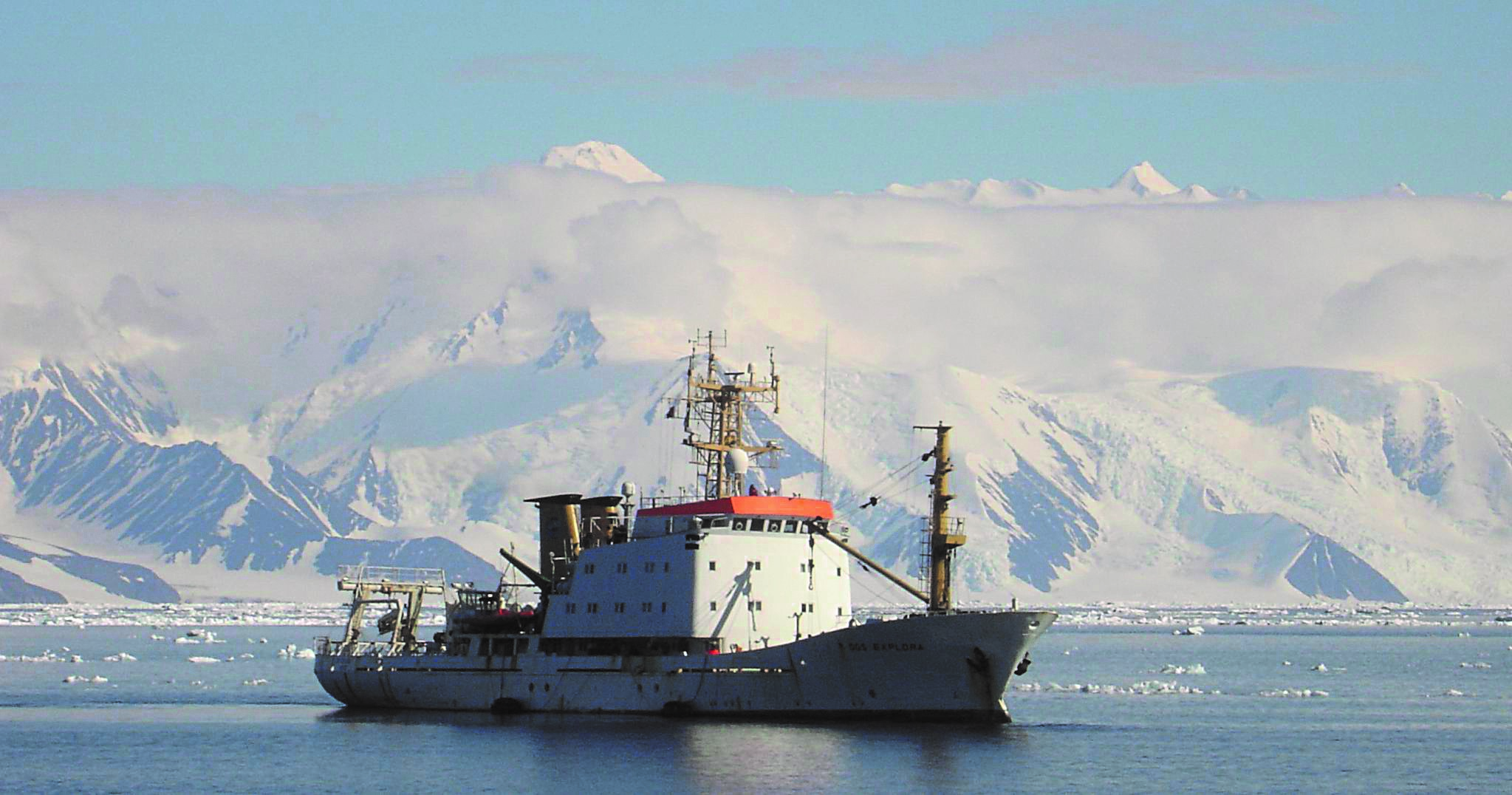
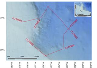
The EUROFLEETS2-ANTSSS expedition took place on R/V OGS Explora between February 17th – February 25th 2017 within the Italian PNRA-funded Antarctic cruise programme to the Ross Sea between January 18th and March 16th 2017. The designated survey areas were situated along the continental shelf edge and rise of the eastern Ross Sea, Antarctica, located between 178°W and 172°W.
|
  |
For more information:
jgales@noc.ac.uk Preliminary results presented at EGU 2017: http://meetingorganizer.copernicus.org/EGU2017/EGU2017-5481.pdf